Scots History to 1400
By Michael Lynch
This is a section from the book "Scotland: a New History" by Michael Lynch which covers Scottish history from the earliest times to the present. There is an Index page of all the sections of the book up to the end of the 14th century which have been added to Rampant Scotland. The pages were previously part of the "Scottish Radiance" Web site.
Early Peoples
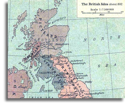
Map of North Britain around AD802 (via Wikimedia)
The terrain of Scotland is the final piece of material evidence to guide us and it is, if anything, the most important. The first map of Scotland was drawn by Ptolemy in his Geography of the second century AD, but it is based on second-hand knowledge of material of a century earlier. The next, compiled no less than eleven centuries later, was part of a manuscript drawn up by a monk of St Albans, Matthew Paris. It is likely that the origin of the first was prepared from the battle plan of an invading army trying to enforce authority on elusive and stubborn native peoples; the second was based probably on reports brought back by travelling monks, but it may have been used later by Edward I, who followed a similar route to that of Agricola in his conquest of the north in 1296. Edward crossed the Forth at Stirling before marching north and east towards the fertile plain of Angus and that of Aberdeenshire beyond the formidable natural barrier of the Mounth [a range of hills on the southern edge of Strathdee in northeast Scotland, usually referred to as "the Mounth" - ED]. The name is a corruption of the Scottish Gaelic monadh, before swinging north-west into Strathspey. In Paris's imagination, the bridge at Stirling across the dangerous, tidal waters of the 'sea of Scotland' was the sole link between Scotland north and south of the Forth. He exaggerated only slightly. Stirling was the first point at which the river might be crossed but it was also in the neck of narrow isthmus of land bridging difficult marshland which was drained only in the eighteenth century. The Forth and its boggy shores separated the halves of the country as surely in 1250 as for the Romans almost twelve centuries earlier.
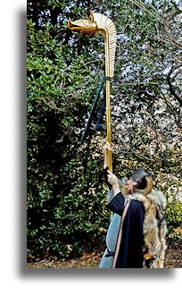
Beyond it, north of the Forth, according to Ptolemy, lay ten tribes. Their names, such as the Venicones placed by him in Fife, the Cornovii in Caithness, or the Creones somewhere between Loch Linnhe and Loch Carron in the west, are relatively unimportant. More significant is the contrast between the tribal patterns north and south of the Forth/Clyde line, which looks as if it was regarded by contemporaries as a natural frontier. The seven tribes south of it controlled seemingly more consolidated territorial tracts than the ten northern tribes which were wedged into comparatively short spans of coastline, but Ptolemy is silent as to how far their authority extended into the vast heartland of the Highlands. (The illustration on the right is a modern reenactor portraying an Ancient Celt, such as a Caledonian or Pict, with carnyx trumpet, crested helmet, chain mail and woad around 100-300 AD; The carnyx was used for war (signaling and intimidation), and ritual occasions).The Novantae controlled Galloway and much of the south-west; they were separated and insulated from the Damnonii, who held a large area in Clydesdale, by the natural barrier of the Carrick hills; and the Votadini, based probably at Traprain Law, controlled most of Lothian and modern Berwickshire and Northumberland. Most of these tribal territories were dictated by the facts of geography. South of the natural barrier of the Forth, the breaks in the terrain ran south to north - a basic, inconvenient physical fact which would perplex and lure to the Forth successive invaders from the Romans in the first and second centuries AD to the Northumbrian kings in the sixth and seventh centuries and Henry VIII of England in the sixteenth. Those breaks in the terrain were few and help explain the make-up of these early tribes: the territory of the Votadini was divided from that of the Selgovae in Liddesdale and Teviotdale and their control of the southern uplands in turn ended at the valley of the Nith, beyond which lay the Novantae.
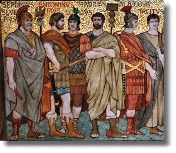
Ptolemy's knowledge of geography and politics north of the Forth was much sketchier, as was that of successive Roman military commanders; neither Roman legions nor intelligence were able to pursue the northern tribes far up the glens and straths which ran east and west. If there was a barbarian heartland, the Romans never found it. The clues left by various later Roman commentators are well known but confusing. For Tacitus, the whole of the mainland from the Forth to the 'northern sea' was 'Caledonia' and Ptolemy not only placed the Caledonii both east and west of the Highland massif but also named the Atlantic coast as the Caledonian Ocean. The territory invaded by a large Roman task force, numbering perhaps 40,000 men under the command of the Emperor Septimius Severus in AD 209, was still called Caledonia. In AD 297, in the first reference to 'Picts', complaints were made of attacks on the Roman fortified frontier by 'Picti and Scoti' (or Irish). And Gildas, a monk born in Strathclyde but resident in Wales for much of his life, who wrote c. 540 of the Roman evacuation of Britain a century earlier in what was the first 'British' history, made much the same distinction about 'the foul hordes of Scots and Picts', who 'were to some extent different in their customs but were in perfect accord in their greed for bloodshed'. A description made in 310 of 'the woods and marshes of the Caledones and other Picts' suggests that the Caledonians were seen, at least by their enemies, as one of the Pictish peoples.
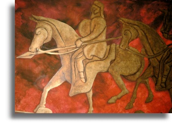
A number of references from the second half of the fourth century onwards suggest a division of the Picts into two peoples. In 368, Ammianus Marcellinus distinguished the Dicalydones (obviously a derivative of the word Caledonii) from the Verturiones, whose name suggests a connection with the later emergence of the Pictish kingdom of Fortriu, located in Strathearn and Menteith between the head waters of the Forth and Tay. This division seems to accord with the analysis of Dio Cassius made in AD 197 between the Maeatae, who 'dwelt next to the cross wall that divides the island in half' (which must mean the Antonine Wall built fifty years earlier across the Forth/Clyde isthmus), and the Caledonians, who lived 'beyond them'. The details are self-contradictory, as many intelligence reports often are, but they point to two sets of conclusions. From an early point, the Pictish tribes seem to have been united not in one confederacy but two, and the division between them probably followed the line of that great natural obstacle of the Mounth, stretching eastwards and thickening from Stonehaven. In contrast, their enemies, whether Roman or (later) British, saw a broader threat - of Pictish and Irish peoples acting in concert.
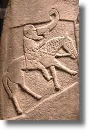
The implications of geography are important. The terrain north of the natural frontier of the Forth/Clyde line was conducive to the development of a large number of separate tribes. In early Ireland, the limits of the tribal chieftain or ri and his tuath or petty kingdom were based not on distance but on difficulty of communication. The result in Ireland was tens of minor tribes, each with its own king and also, to some extent, its own distinctive customs and law. The surprise is surely not that Ptolemy detected ten northern tribes in Caledonia but that he did not trace more. The emergence of two loose confederations of tribes by the end of the second century AD - probably in part a reaction against a common Roman enemy - suggests a need to guard against an over-deterministic view of Scotland's geography. Minor physical barriers could become stepping stones between tribes; the links between individual members of the confederations surely suggests a great amount of migration and contact by sea. Equally, it is probable that the two Pictish confederations fitted the lines imposed by the two greatest geographical barriers of all, the Forth and the Mounth. Any authority, whether native king or invading army, had difficulty in imposing its will across the vast territory between the Forth and the Northern Isles. The sea, always in early history a conduit for mutual contact and influence rather than a barrier, is as likely to have linked the different Pictish peoples of Caledonia with Ireland as with themselves.
Return to Index of Scots History to 1400
